
Sliabh an tSratha Greadaithe [Stragraddy Mountain]
Good walks are even better shared.
Overview
Sliabh an tSratha Greadaithe [Stragraddy Mountain]
Located in the heart of Connemara, near C082245, Sliabh an tSratha Greadaithe provides a captivating experience for hikers. Standing at a respectable 565 meters (1,854 feet), it's a Marilyn classification mountain that shouldn't be underestimated.
Geology
This mountain's rocky facade is primarily granite, fashioned by ancient glacial activities. The remnants of these glacial periods create a unique landscape, complete with sparkling streams and scattered boulders that make you feel as if you've stepped into a natural art gallery.
Routes
While there are several ways up Sliabh an tSratha Greadaithe, the Killary Harbour Route and Doolough Valley Route top the list for best-loved pathways. These trails present not just a means to reach the summit but a charming odyssey through the picturesque Connemara countryside. Each route features its own blend of challenges, and both are well worth the effort.
Killary Harbour Route
An 8-kilometre journey that allows you to soak in the majestic views as you hike up the slopes, best tackled in about three hours.
Doolough Valley Route
This 9.5-kilometre trek, taking approximately four hours, offers a more rugged experience, ensuring you get up close with the wild, untamed beauty of the Irish hills.
Summit Features
Upon reaching the summit, you can celebrate your success at a stone cairn next to a trig point, perfect for those all-important selfies and snack breaks while you take in the scenery.
Terrain Type
Be prepared for a mixed bag underfoot: rocky paths, grassy slopes, and the occasional boggy pit. The terrain can be as temperamental as the Irish weather, so tread carefully and wear those sturdy shoes!
Views
The panoramic views from the summit of Sliabh an tSratha Greadaithe are nothing short of breathtaking. You can see the sparkling waters of Killary Harbour, the rugged outlines of the Twelve Bens, and on clearer days, the expansive Atlantic Ocean.
Hazards
As with any trek, be aware of potential hazards. The rocks can be slippery, particularly if they've been graced by rain, and you may encounter sudden weather changes. Always be prepared and keep an eye on the forecast before setting off.
Nearby Summits
If you're feeling particularly adventurous, consider extending your trek to nearby peaks such as Ben Gorm and Mweelrea, both offering stunning views and rewarding trails.
Access
Accessing the mountain is straightforward, especially with parking available at Killary Harbour. It’s advisable to arrive early as spots fill quickly in peak season. Buses run from Westport to the nearby village of Leenane, making it accessible for those who prefer not to drive.
Facilities
Once you're done hiking, head back to Leenane for a bite at the local cafe or a hearty meal in one of the pubs. Facilities nearby include toilets at the harbour and friendly locals who are always eager to share tips and stories of the land.
History
The mountain's name, rich in Irish heritage, translates to 'mountain of the rustling stream.' It’s a fitting title, as the area's waterways flow with a serene beauty. The mountain carries significant cultural weight, steeped in local folklore and history.
In conclusion, Sliabh an tSratha Greadaithe provides an unforgettable outdoor experience, blending natural beauty with a touch of adventure. Whether you're a seasoned climber or a casual walker, this mountain is sure to leave you with memories as high as its peaks.
Explore routes near Sliabh an tSratha Greadaithe [Stragraddy Mountain]
Public walks starting within 80 km of this hill. Nearby does not mean a route reaches the summit; check its map and access before setting out.
Derry~Londonderry City Walls Circuit
View route
Banagher Glen and Forest: complete higher-return circuit
View route
Route planning notes
These notes describe possible approaches, not verified navigable routes or permission to cross land. Check current paths, local access rules and conditions before setting out.
Killary Harbour Route
This is a popular route that starts at Killary Harbour and provides spectacular views as you ascend the mountain slopes.
Doolough Valley Route
Ascending from Doolough Valley offers a scenic and more remote experience, passing through boggy ground and heather.
Make a day of it, together
Find someone to share the walk with, or organise a day out along a route you like.
Hill facts and local notes
Classifications
Elevation
285m
935 ft
Prominence
159m
Coordinates
55.0678, -7.8724
C082245
OS Map
02
At the Summit
The summit is crowned by a large stone cairn, providing a perfect spot for a well-earned snack. A trig point adds to the landscape, marking the height of this proud mountain.
Terrain & Geology
The mountain is primarily composed of granite, characteristic of the Connemara region. The surrounding landscape features glacial deposits and rocky outcrops that reveal a tantalising glimpse into the region's geological history.
Views & Scenery
From the summit, revel in sweeping vistas of Killary Harbour, the Twelve Bens range, and the endless Atlantic Ocean, perfect for daydreaming or pondering life’s great mysteries.
History & Heritage
Name Origin
The name 'Sliabh an tSratha Greadaithe' translates to 'mountain of the rustling stream,' a nod to the area's rich natural waterways.
Historical Significance
The region is steeped in folklore, with stories of ancient warriors and mythical creatures lingering in the air.
Getting There & Facilities
Check current local access restrictions, parking rules and transport timetables before travelling. These notes do not confirm public access to the summit.
Parking
Parking is available at the viewpoint near Killary Harbour. Make sure to arrive early as spaces can fill up quickly during peak season.
Public Transport
Buses run from Westport to Leenane, though a car is recommended for easier access to trailheads.
Nearby Facilities
Leenane has a quaint cafe and several pubs serving hearty meals, as well as toilet facilities near the harbour.
Safety Information
Known Hazards
- Slippery rocks, particularly after rain, and sudden changes in weather are common. Ensure you wear appropriate footwear and check forecasts before setting off.
General Safety Tips
- Check weather conditions before setting out
- Carry appropriate clothing and equipment
- Let someone know your planned route
- Take a map, compass, and GPS device
- Carry emergency supplies: food, water, first aid kit, torch
Hills
Some common questions about the hills answered
Are there group walks up Sliabh an tSratha Greadaithe [Stragraddy Mountain]?
Many walkers use Walkmates to join or organise walks with others. You can check for group walks around Sliabh an tSratha Greadaithe [Stragraddy Mountain] through the maps
Are there other walkers around Sliabh an tSratha Greadaithe [Stragraddy Mountain]?
Activity varies by location and time, but Walkmates lets you see whether others have shared walks or shown interest in this area. Find other people through the walking friends search walking friends for Sliabh an tSratha Greadaithe [Stragraddy Mountain] search or of course create your own walk for Sliabh an tSratha Greadaithe [Stragraddy Mountain]
Can I organise a walk to Sliabh an tSratha Greadaithe [Stragraddy Mountain]?
Yes. If there aren’t any walks listed already, you can create a walk and make it available for others to join.
If you're signed up to Walkmates, you can create a walk to Sliabh an tSratha Greadaithe [Stragraddy Mountain].
How do I find a walk up this hill?
There are often multiple ways to walk this hill, depending on experience and route preference. Walkmates helps you explore walks and routes that others have shared.
Can I suggest a new route up Sliabh an tSratha Greadaithe [Stragraddy Mountain]?
Yes. You can suggest or create routes to share with others. Walkmates focuses on the social side of walking, so routes are used to help people organise walks and explore areas together, rather than as detailed navigation tools or route libraries.
Other uses really appreciate knowledgeable walkers sharing their routes. Share your favourite route to Sliabh an tSratha Greadaithe [Stragraddy Mountain] here
The is an error or something incorrect about this hill. How do I let you know?
We always strive to keep the information on Walkmates as accurate as possible. If you find an error, please let us know through the contact form and we'll aim to correct it as quickly as possible
Community Discussion
Comments
Location
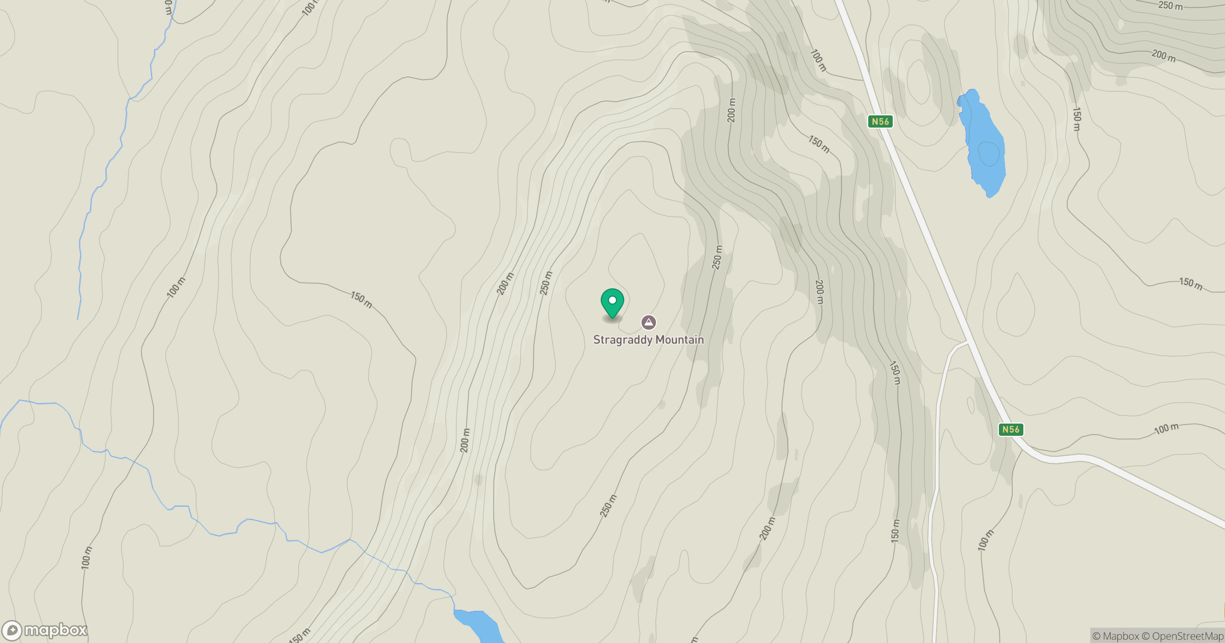
Grid reference: C082245
View on OpenStreetMapOpens a map in a new tab, centred on the hill.
Hills within 30 km
Straight-line distance, not a walking route or confirmation of access.
No comments yet. Be the first.